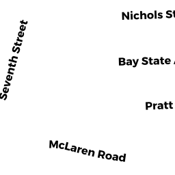
43 NICHOLS ST
Owner Information
SCHNEIDER DEVIN JARED & LAURIE S
43 NICHOLS ST
TEWKSBURY, MA 01876


Property Details
43 NICHOLS ST is classified as a Single Family Residential (Ranch).
The primary structure on this property was built in 1961. There are 2,620ft2 of built area within this property. There is 1,000ft2 of residential/living space within this property.
43 NICHOLS ST is valued at $345,500. The land is valued at $165,500 and the structures are valued at $178,300. There is an additional valuation of $1,700 on this property.
This property is in Zone R40. Confirm with local Zoning Board authorities to ensure there are no overlays or other easements on this property.
The most recent deed for 43 NICHOLS ST is recorded at the local registrar in Book 0224, Page 0071. 43 NICHOLS ST was last sold on Friday, March 1, 2019 for $357,500.
Assessment data from fiscal year 2021.
Flood Data
According to the FEMA National Flood Hazard Layer, this property does not appear to be in a flood zone. It may also be in an area not yet reviewed. Nonetheless, confirm this information prior to taking any action.
To view the flood hazards around this property, create a FEMA "Firmette" Map of the area around 43 NICHOLS ST.
Broadband Internet Providers
| Provider | Type | Bandwidth (mbps) | |
|---|---|---|---|
| Viasat Inc | Satellite | 100 | 3 |
| GCI Communication Corp. | Satellite | 0 | 0 |
| Verizon New England Inc. | DSL | 1 | 0 |
| Verizon New England Inc. | Fiber | 940 | 880 |
| Comcast | Cable | 1000 | 35 |
| VSAT Systems, LLC. | Satellite | 2 | 1 |
| HughesNet | Satellite | 25 | 3 |
| T-Mobile | Fixed Wireless | 25 | 3 |
Broadband service provider data from December 2020.
Adjacent Properties
- 47 NICHOLS ST
Single Family Residential owned by MORRELL NICOLE E & MCCREEDY WILLIAM D - 145 SEVENTH ST
Single Family Residential owned by BOYLE MICHAEL & DEBORAH - 2235 MAIN ST
Other, Open Space owned by THE BEVERLY CORPORATION - 2235 MAIN ST
Industrial Condo owned by 2235 MAIN STREET NOM TRST - 2235 MAIN ST
Industrial Condo owned by 2235 MAIN STREET NOM TRST - 2235 MAIN ST
Industrial Condo owned by 2235 MAIN STREET NOM TRST - 33 NICHOLS ST
Single Family Residential owned by GARCIA SUN GUK & JAMES G SR